Mitchell’s Fold: A Stone Circle Between Hill and Horizon
- Feb 1
- 13 min read
Updated: May 5
Welcome to Stone Temple Gardening
This post marks the final part of a series of writings and films drawn from our summer journey through some of the most resonant prehistoric landscapes in Britain. What began in the great ceremonial complexes of Avebury and Stonehenge gradually carried us westward, following stone, source, and setting rather than any fixed itinerary.

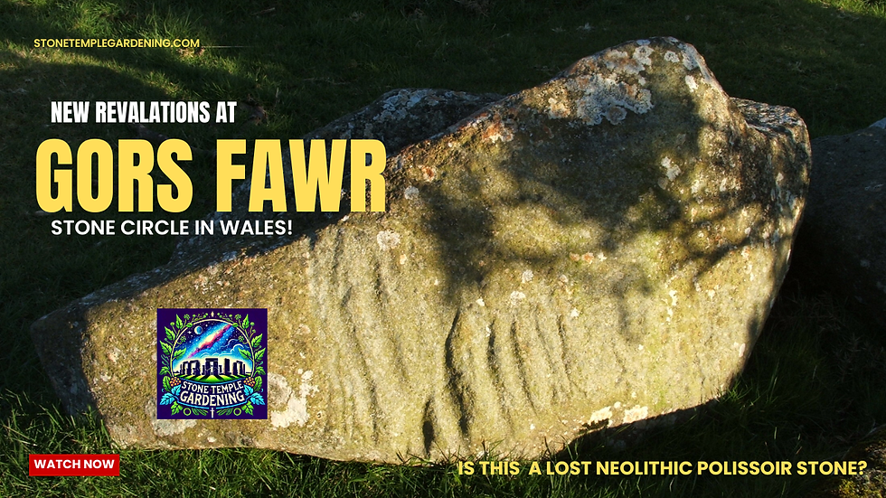
From Wessex we travelled to Preseli in west Wales, to the hills from which the Stonehenge bluestones were originally taken, and to the quieter, more intimate monuments that lie scattered across west Wales and the borderlands. Along the way we visited Gors Fawr stone circle, Pentre Ifan, Llech-y-Drybedd, Carreg Coetan Arthur, and Gwal-y-Filiast, walking each site slowly and returning to many of them at different times of day. Each visit fed into both the writing here and a parallel series of short films, which accompany these posts on the Stone Temple Gardening YouTube channel.
Taken together, the series has been less about cataloguing monuments than about attending to how they are encountered. Movement, approach, horizon, stone, and light have guided the work throughout, allowing each place to speak on its own terms rather than being folded too quickly into explanation or theory. The aim has been to understand these sites as lived landscapes, shaped as much by paths, pauses, and thresholds as by architecture.
Mitchell’s Fold brings this journey to a close. Set high in the Welsh Marches, just on the English side of the border, it sits between hills and horizon, gathering many of the themes traced along the way. Stone and source remain visibly connected. Approach and arrival matter. Sky and ground are held in careful balance, with placement doing the work that monumentality does elsewhere.
As the final stop on this particular journey, Mitchell’s Fold offers no conclusion in the sense of an answer. Instead, it provides a place where the threads of the series draw together, not as an argument resolved, but as an experience brought into focus.
Films accompanying this series, including site visits to Avebury, Stonehenge, Preseli, Gors Fawr, Pentre Ifan, Llech-y-Drybedd, Carreg Coetan Arthur, Gwal-y-Filiast, and Mitchell’s Fold, are available on the Stone Temple Gardening YouTube channel. Each film follows the same slow, landscape-first approach as the writing here, allowing stone, movement, light, and setting to lead the eye.
Approach and Arrival: St Dogmaels to Mitchell's Fold
Our summer retreat to beautifal west Wales over, we left St Dogmaels and Cardigan with yesterday's previous sites still fresh in mind, the wooded hollow of Gwal-y-Filiast and the open estuary light at Carreg Coetan Arthur lingering like luminous afterimages. The A487 carried us north, unwinding along the coast in long, grey arcs. Sea appeared and vanished in flashes as the road rose and dipped, fragments of water and distant headlands briefly revealed before slipping away again. It felt like travelling along the edge of something half seen, half remembered.
We broke the journey at Aberystwyth to meet old friends for coffee, a pause that grounded the day before the long pull inland. From there the road changed character. The A44 climbed steadily away from the coast and into the interior, the land tightening and then opening again in slow, patient rhythms. A rally of Lambrettas, Vespas and Piaggios flowed past in bright, buzzing clusters, their riders carrying a lighter sense of time with them, as though the road were an event rather than an obstacle.
Not everyone shared that ease. The occasional van pressed close from behind, drivers chafing against speed limits and bends, caught in the familiar urgency of elsewhere. Their impatience felt less personal than symptomatic, the low pressure of modern acceleration leaking into a landscape that has little interest in haste. Below and above us the Welsh borderlands unfolded quietly, valleys falling away, ridges lifting into view, the road suspended between them.
By late afternoon we reached our rural Airbnb near Bishop’s Castle. A brief walk through the town followed, its old streets and picaresque buildings offering a gentle, unshowy welcome before dinner. Then the day closed, and with it the sense of motion.

We were up early the next morning, setting off for Mitchell’s Fold as the light was still finding its footing. The road out was rural and largely deserted, threading through small villages with a muted, almost colourless calm. Gradually it rose, narrowing into an older track that climbed onto higher ground. At the small car park, a converted 1950s bus sat quietly, now a camper, its presence an unexpected echo of the travelling convoys of the 1980s. A reminder that these uplands have long drawn those willing to move more slowly, to linger, and to look.
Ahead, the land opened. Mitchell’s Fold waited beyond the rise.

Mitchell’s Fold Stone Circle and Its Landscape Setting
Mitchell's Fold stone circle does not sit on a summit, nor does it announce itself from afar. It is reached by ascent rather than arrival, set on a saddle of high ground where the land briefly gathers itself between hills. Approaching it, there is a sense of pause rather than culmination, as though the ground has slowed you deliberately, offering passage rather than command.

To the south the bulk of Corndon Hill rises steadily, its presence felt more as weight than as backdrop, a long-familiar landmark of the Welsh Marches. To the north, Stapeley Hill comes into view, the source of the stones themselves, so that monument and quarry remain held together within the same field of sight. The approach never lets you forget where the material has come from.

As one arrives, the wider landscape resolves directionally. Eastwards the land tightens into ridges and broken ground, movement constrained, sightlines shortened, the terrain interruptive and enclosing. Westwards, by contrast, the ground loosens and falls away, the horizon opening into distance and sky. Mitchell’s Fold occupies the hinge between these conditions, encountered not as an object placed upon the land, but as something reached through it.

Form, absence, and entry
Measured today, the circle resolves into a slightly irregular oval, roughly thirty metres across at its widest point. Fifteen stones remain visible, unevenly spaced and varied in height. Antiquarian observers writing in the eighteenth and nineteenth centuries consistently describe a fuller ring, closer to thirty stones, a scale entirely consistent with Bronze Age circles across the Welsh Marches and adjacent uplands. What survives is clearly reduced, but the underlying order remains legible.

Most of the stones now sit low in the turf, weathered and diminished, yet two taller uprights continue to assert themselves. Their survival suggests that variation in height was integral to the original composition, a deliberate modulation rather than the accidental outcome of later loss. Early accounts also refer to a paired entrance, now broken and incomplete, but once sufficient to organise how the circle was approached and entered. Even in ruin, the sense of a structured arrival persists.

Several antiquarian sources record a substantial central stone, long since removed or buried. Its absence is keenly felt. A marked centre places Mitchell’s Fold firmly within a Bronze Age tradition dating to around 2000–1500 BC, in which circular space is not simply enclosed but internally ordered. The circle does not merely contain ground. It gathers attention inward, toward a focal point now known only by its loss.
Thresholds in the landscape

Due South beyond the ring itself, the monument extends into the surrounding landscape. A nearby cairn reinforces the sense of ceremonial density, while an outlying standing stone sits apart from the circle yet remains visually and spatially connected. Encountered along the line of approach, this stone marks a subtle shift in register, a point at which ordinary ground gives way to a more structured zone. Its role is not referential but experiential. It announces passage. The view from here is magnificent, as if this is the real foci of the site. It has a somewhat suggestive shape of a skull or head. Clearer in the video.

Taken together, circle, entrance stones, central focus, cairn, and outlier form a composed sequence rather than an isolated monument. Mitchell’s Fold emerges as a place shaped through movement and encounter, its meaning unfolding through approach and transition rather than revealing itself all at once. What we meet today is a layered remnant of a Bronze Age landscape that was once carefully staged, its power carried not only by what still stands, but by the spaces between.
Stone and source

The wider setting reinforces this reading. Nearby hilltops, ridges, and passes suggest long-established pathways across the high ground, routes shaped by repeated movement rather than formal construction. All the stones at Mitchell’s Fold are dolerite, taken from nearby Stapeley Hill, a dark volcanic outcrop whose rock stands apart from the surrounding sedimentary landscape. The circle is not built from chance stone or distant imports, but from material deliberately extracted from a visible source and re-set on the saddle below. Hill becomes circle. Mass becomes perimeter. Geology is translated into architecture.
This act binds monument to terrain in a direct and legible way. From within the circle, the source remains present both in sight and in substance. The stones carry the hill with them, allowing the upland geology to be re-articulated as a structured space that holds absence at its centre.
Borderland and continuity
Later expressions of power echo this same logic of position and passage. Our stay near Clun Castle, a Norman fortification raised to police the border, sharpened this continuity. Like the circle, the castle occupies a place that must be watched and crossed. Yet where the castle asserts authority through enclosure, elevation, and defence, Mitchell’s Fold works more quietly. It organises space through presence, curvature, and relationship, shaping movement rather than restricting it.

A wider ceremonial field
Seen within its wider setting, Mitchell’s Fold no longer reads as a solitary monument set adrift on the uplands. It sits within a scattered but coherent field of stone circles and related structures spread across the nearby hills. Just to the north-west lies the Hoarstones stone circle, the closest and clearest parallel. Further west, the Nine Stones of Middleton overlook the Camlad valley, while fragmentary remains such as the Five Stones near Llandinam suggest that this upland tradition once reached further than the surviving stones now imply.
Equally important are the absences. Sites such as The Whetstones circle, recorded historically but now largely erased, point to a denser ritual terrain than the present landscape suggests. Traces on Stapeley Hill itself, close to the dolerite source, hint at a close relationship between quarrying, movement, and ceremonial marking. Circles here appear not as isolated destinations, but as moments of gathering along ridges, passes, and routeways. (Also, see footnote 1.)
Placed within this field, Mitchell’s Fold functions as one node among many. Its saddle-point location, its outlying stone, its lost centre, and its relationship to cairn and quarry echo features seen elsewhere in the region. What distinguishes it is not uniqueness, but clarity, the circle is broken and worn, difficult to capture in mind and on camara. Enough survives however for the broader logic of the landscape to remain readable.
Orientation and sky
No firm astronomical alignment has been demonstrated at Mitchell’s Fold, and it would be a mistake to force one. The site does not readily lend itself to precise calculation, nor does it announce a single dominant direction. What it does offer is something quieter and more durable: a setting that makes the sky noticeable.

The saddle position provides clear horizons in several directions, particularly to the west and south-west. The openness of the ground and the absence of enclosing slopes allow light, weather, and seasonal change to register clearly. Modern visitors at moments such as the winter solstice and other calendar dates are therefore not arbitrary acts of projection, but reasonable responses to what the place affords: wide sky, legible horizons, and a strong sense of time passing through light rather than measurement.
Rather than asking what Mitchell’s Fold points at, it may be more productive to ask what kinds of celestial events become visible here, and how the repetition of those events might have structured gathering and return. The circle's wide vistas appears less concerned with fixing a moment than with making cycles perceptible.
My own measurment of the orientation between the circle and the outlying stone showed an interesting alignment. The spatial relationship between the outlying stone at Mitchell’s Fold and the centre of the circle defines an axis that is close to true north–south, rather than the oblique seasonal corridors often marked as associated with solar events, this orientation invites consideration of a lunar reading, particularly in relation to the Moon’s long 18.6-year cycle. At this latitude, a near-meridional north-south axis does not frame lunar rising or setting points, but instead aligns with the Moon’s passage across the sky at culmination, when it reaches its most northerly or southerly height during major standstills and their partner, the minor standstills. Such events unfold slowly and require repeated observation across many years, fitting a monument structured around recurrence rather than single calendrical moments. The paired entrance stones, slightly offset from this axis and oriented toward the south-east, appear to organise approach and bodily movement rather than replicate the outlier’s function, suggesting a choreography in which different elements of the monument engage distinct temporal and perceptual registers. This interpretation remains speculative and would benefit from detailed horizon modelling, precise bearing checks, and comparison with other upland circles in the Welsh Marches where near-cardinal orientations have been tentatively linked to lunar observation.

I feel there is a lot of work to be done here that would prove fruitful for those with the skills and access.
Folklore as afterimage
Local tradition tells that Mitchell’s Fold was once the gathering place for a miraculous cow, a creature of such abundance that it could feed the surrounding communities without fail. The cow was brought regularly to the circle, where it was milked for the benefit of all. As long as the ritual was carried out properly, the milk flowed freely, sustaining the people who gathered there.
The story turns on transgression. A witch, driven by greed, sought to take more than her share. She brought a sieve to the circle and attempted to milk the cow into it, hoping to extract limitless milk while leaving nothing behind. The act broke the balance that sustained the place. The cow was drained dry, the abundance lost, the witch (Mitchell in some versions) was turned into one of the stones (see the video) and the power of the site extinguished. In some versions of the tale, the stones themselves are said to have fallen or been scattered as a consequence, the circle left diminished as a visible reminder of the breach.
It is a story dense with moral instruction. Plenty depends on restraint. Shared benefit requires limits. Excess destroys the very source it seeks to exploit. The landscape is not punished arbitrarily, but altered as a direct result of human/supernatural action.

What matters here is not the tale, but its function. The legend recognises Mitchell’s Fold as a place once associated with gathering, sustenance, and communal order, even if the original practices that gave rise to that association had long since faded from memory. Folklore does not preserve prehistoric meaning intact. It replaces it, translating an older, inaccessible significance into the ethical language of a later world.
In doing so, the story keeps something essential alive. It remembers perhaps that this was a place where balance mattered, where abundance was conditional, and where the misuse of power had consequences written into the land itself. The stones become not explanations, but warnings, their altered state folded into a narrative that makes sense of loss once understanding has slipped beyond reach.
A place of balance
Mitchell’s Fold is not a monument of spectacle or precision. It does not dominate a single view, nor does it impose a rigid geometry on the land. Instead, it occupies a carefully chosen balance point: between hills, above water, within a cluster of stones, open to multiple horizons.
It is a place designed less to be looked at than to be stood within. The circle organises attention rather than directing it, shaping movement and awareness of land and sky together without insisting on a single meaning.
In this sense, Mitchell’s Fold fits comfortably within a broader prehistoric tradition that treated stone not as symbol or statement, but as a means of guiding human presence towards perception of place. Its power lies not in what it declares, but in what it allows to be noticed. See my video for some speculations on what can be perceived in this monument and landscape.
Departure

To the west, the land falls away into a broad, rolling prospect, a deep tapestry of green laid out below the higher ground. Fields and hedges soften into one another, their boundaries loosening with distance as the hills descend in slow, measured layers. To the east, the ground tightens. Ridges rise, sightlines shorten, and movement feels more channelled. Mitchell’s Fold sits precisely between these conditions, holding openness and containment in balance without resolving the tension.
Leaving the site, that balance lingers. The stones recede gradually, slipping back into turf and contour rather than vanishing at once. Nothing here insists on a final view. Instead, the monument releases you slowly, returning you to paths, slopes, and wider ground. Mitchell’s Fold is encountered not as a statement, but as a passage, one that continues to shape perception even after the circle itself is behind you.
Footnote 1,
Not far from Corndon Hill, on ground that neither asserts itself as summit nor withdraws into valley, lies what is called New House Long Barrow. The name suggests intention and design, yet the place resists both. It is a low, elongated rise, stone-laden, its form emerging gradually as one walks rather than declaring itself at a distance. Excavation has offered no burials, no clear architecture, and the mound has since been understood as a natural outcrop, lightly worked or cleared. But this absence does not diminish it. Approached on foot, the feature gathers meaning through position and pause. It occupies the same breathing space of the land as Mitchell’s Fold, part of a ceremonial field shaped by movement across the Corndon massif. Here, recognition matters more than construction. Viewed from the boundary stone it resembles a figure lying on its back. The ground itself suggests attention, and whether raised by hands or by geology, the place holds as a stopping point, a fold in the journey where the land asks to be read rather than measured. The long barrow that may never have been a barrow still works, quietly, through form, placement, and return.
Thanks for reading. Please like, share and leave a comment if you havek any observations or thought to share.
Alex Peach
January 2026
Stone Temple Gardening is built through fieldwork: walking, filming, photographing and testing prehistoric landscapes on the ground. If this work interests you, you can support future site visits and research here.


😊