Nine Ladies Stone Circle: A Hidden Imbolc–Samhain Alignment on Stanton Moor
- Mar 29
- 8 min read
Updated: Jun 9
There is a line running across Stanton Moor.
It links the Nine Ladies, the King Stone, the Andle Stone and Doll Tor.
Follow it west-south-west and it resolves onto the setting sun at the turning points of the year, the moments that mark the shift between winter and spring, summer and autumn.
This is not immediately visible. You have to walk it. You have to stand within it. And when you do, the placement of these stones begins to feel less like distribution, and more like structure.
Stone Temple Gardening: Landscape First, Monument Second
Stanton Moor is often described as a scatter of prehistoric monuments: stone circles, cairns and standing stones spread across a gritstone plateau.
But this view misses something more fundamental. The monuments do not simply occupy the landscape. They organise it.
Stone Temple Gardening begins with a simple premise: landscape comes first. Like a gardener reading soil, light and exposure before planting, this approach starts with the ground itself. Prehistoric monuments are not the origin of significance, but its outcome. They mark places where movement, attention and memory had already gathered over time. Rather than treating monuments as isolated objects, this method reads the landscape as a system. Ridges, routes, horizons and natural rock formations are not background features, but the framework within which monuments were later set. The question is simple: why this ground?
Today we look at Stanton Moorh but here are other journeys I have written about where this same process unfolds. Nearby Arbor Low henge and circle and Belas Knap longbarrow.
Stanton Moor and the Nine Ladies Stone Circle Alignment and the 240° Sunset Line. A Landscape System, Not a Single Site
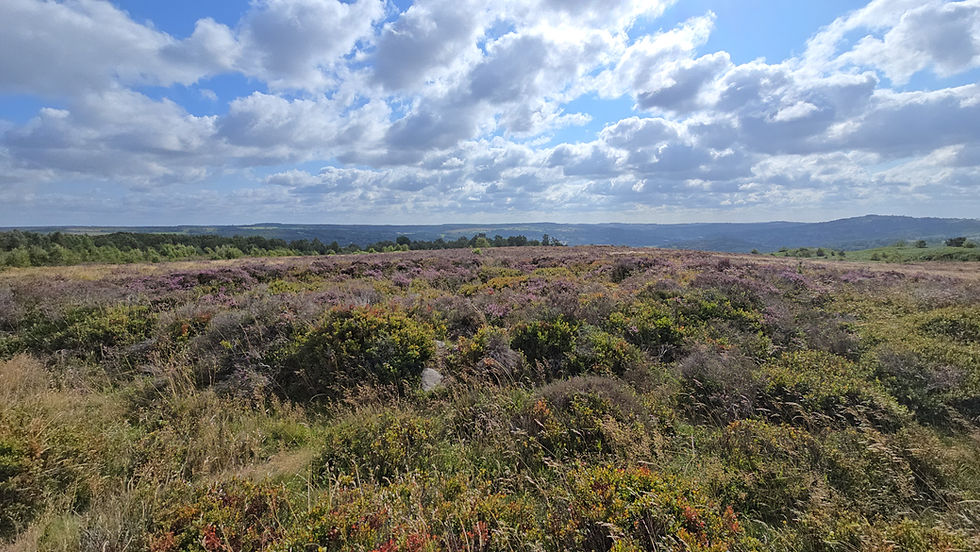
High on the gritstone plateau of the Peak District, Stanton Moor appears at first glance sparse, even empty. But this is deceptive. This is not a single site, but a landscape system. Within a relatively compact area lies a concentration of prehistoric features: stone circles, cairns and barrows, standing stones, and marked natural outcrops. These are not randomly distributed. They form a network that only becomes visible when encountered through movement across the moor. To its east is the gritstone plateau that includes sites like Arbor Low.
Archaeology of Stanton Moor: Bronze Age Monuments and Burial Landscapes

The archaeological record shows sustained activity across the Early to Middle Bronze Age, though earlier origins remain possible. The best-known monument is the Nine Ladies stone circle, a small ring of low stones set within a deliberately levelled platform. Nearby stands the King Stone, a low solitary monolith positioned just to the west-south-west of the circle. Other circular features, including Doll Tor and the more fragmentary Central Circle, both show variation in form, from clear stone settings to low earthworks.
Most numerous are the cairns and barrows, more than seventy in number, many containing cremation burials and burnt bone.
This is not a single designed complex, but a landscape returned to and marked repeatedly over time.
Approaching Stanton Moor: Movement from Robin Hood’s Stride and Rowtor Rocks
Stanton Moor can be approached from many directions, but not all approaches structure experience in the same way. One route stands out. From the south-west, a ridge route—once walkable before modern boundaries and marked by rock art—runs from Robin Hood’s Stride through the heavily worked outcrop of Rowtor Rocks and up onto the moor, culminating at the Cork Stone (see here for a description of the full route). This striking natural pillar marks the point where the ascent gives way and the plateau opens. Before modern tree cover, it would have been visible from a considerable distance, its form and position establishing it as a clear point of orientation and entry. For these reasons, this approach is a plausible primary route into the landscape of Stanton Moor.

Crossing the Moor: Cairn Fields, Movement and the Eastern Horizon
From here, movement is drawn onto the moor. The ground is broad and lightly undulating, but movement is not unrestricted. A clear path follows the line of the ridge, shaped by the ground itself. While its present form is modern, any earlier route would likely have followed a similar line.

As movement settles into a south to north course, the Bronze Age burial cairns begin to appear. At first, they are scattered, then they gather. Each mound marks a point, but together they create continuity. Movement is guided less by a path underfoot than by the repetition of features across the landscape. At the same time, the eastern horizon opens as the land falls toward the Derwent Valley, drawing attention toward the direction of first light.
From Cairns to Circles: The Nine Ladies Stone Circle
Within this zone, circular forms begin to emerge. Some stand clearly, others survive only as low earthworks, but their distribution reinforces the line of movement. The progression through cairns becomes a progression through monuments, the scattered field giving way to more clearly defined points of focus.
At the northern end of this sequence lies the Nine Ladies Stone Circle. It is not encountered as an isolated monument, but as the culmination of a gradual build of attention just before the moor's end.

The King Stone and the Turning of Movement
Movement does not end here. From this approach, after encountering the circle, another marker reveals itself. The single monolith of the King Stone stands to the left of the circle. It does not impose, but suggests a new orientation, drawing attention away from the ring toward itself and the west-south-west alignment.
So the direction shifts. What had been a south to north progression begins to pivot.

The Return Route: Andle Stone, Doll Tor and the Western Horizon
From here, the return begins. The path trends back across the moor, descending toward the Andle Stone, a large natural outcrop marked with unusually large cup-and-ring carvings. Unlike the stone circles that bracket the line, it is not constructed but selected and marked, placing it firmly within the same cultural landscape. The views from the top down to the setting of the sun are magnificent (I have written about how natural rocks can present forms that draw recognition to place first before marking by monuments at Bryn Celli Ddu passage tomb in Wales).

From this point, movement continues toward Doll Tor, a smaller stone circle positioned at the edge of the plateau, where the ground falls away toward the western horizon. If the approach to the Nine Ladies from the Cork Stone privileges the view toward the sunrise light of the east, the return carries movement into the western setting sun.

Alignment on Stanton Moor: The 240° Western Axis
The line from the Nine Ladies through the Andle Stone to Doll Tor follows a consistent west-south-west direction of 240 degrees from north. Any landscape containing multiple monuments will inevitably produce chance alignments if enough lines are drawn between points, and this must be acknowledged at the outset. What distinguishes this case is that the line is not arbitrarily selected but follows a coherent sequence of significant features: it is bounded by two stone circles and passes directly through a marked natural outcrop that already holds attention within the landscape. The King Stone sits slightly offset from this line, but over such a short distance that the deviation is not perceptible in practice. It functions not as a precise marker, but as an indicator of movement along this western axis.
Horizon and Archaeoastronomy: Sunset Alignment and the Bronze Age Landscape
From the Andle Stone and Doll Tor, the ground falls away toward the Ivy Bar Brook valley before rising to a low distant ridge. Terrain modelling shows that this ridge forms a low western horizon, less than one degree in apparent altitude. This allows the sun to move visibly along it over several days rather than disappearing behind a close obstruction. At this latitude, an azimuth of 240 degrees corresponds to sunset at the cross-quarter days of early November and early February corresponding to Imbolc (Candlemas/St Brigid’s Day) and Samhain (Halloween). The line marks the important agricultural transitions between winter and spring and summer and winter. I have written about a similar orientation at West Kennet Long Barrow near Avebury here.

Whether this was intentional cannot be demonstrated conclusively. But the alignment is clear, its precision measurable, and its relationship to the horizon consistent. The connection between movement, monument and sky is coherent.

Place First: Rethinking Prehistoric Monuments and Landscape
The evidence from Stanton Moor does not begin with monuments. It begins with the ground. The grit stone ridge draws movement from the west. The Cork Stone marks entry. The land draws you north through the moor. The cairns gather attention to the east. The Nine Ladies resolves this movement. The King Stone draws attention to the west-south-west line. The body is naturally drawn to this marker and turns. Further along the line you leave the moor and reach the Andle Stone that anchors the alignment to the setting sun. Moving further on, Doll Tor completes the alignment and from there return to the ridge back to Robin Hood's Stride. At every stage, the land presents structure first. The monuments follow.
This is the pattern. Natural features anchor attention. Movement returns to them. Marking intensifies them. Monuments formalise them. The alignment does not impose order onto an otherwise neutral landscape. It emerges from the same conditions that structure movement across the plateau: the fall of the ground, the openness of the horizon, and the repeated return to particular points within it.
Place comes first.
The monuments do not explain the landscape.
The landscape explains the monuments.
Beyond the plateau, the ridge toward Robin Hood’s Stride presents a different kind of landscape, one where recognition precedes monument. I explore this in the next two articles, here on the Grey Ladies Stone Circle near Robin Hood’s Stride, and here for the gritstone rock art corridor between the moor and Stride.
Dr Alexander Peach
March 2026
Stone Temple Gardening is built through fieldwork: walking, filming, photographing and testing prehistoric landscapes on the ground. If this work interests you, you can support future site visits and research here.


What a marvellous story about these stones! Thanks again Dr Alex Peach! "The monuments do not explain the landscape. The landscape explains the monuments. " Perfect!😍